In the sim 
Real life flying is coming soon … My New Year’s resolutions for 2020 are (1) get my medical, (2) get current again, and (3) get my instrument rating. A bonus would be getting my multi-engine rating as well.
In the sim
Real life flying is coming soon … My New Year’s resolutions for 2020 are (1) get my medical, (2) get current again, and (3) get my instrument rating. A bonus would be getting my multi-engine rating as well.
These goals are hard to achieve, at least under my perspective , hope you all the best and I would love to see your real life flying pictures!
Came across this really excellent ebook on the Apple Books Store. If you want to fly the DA62 (in real life or in a simulator such as X-Plane), this is $20 US well spent.
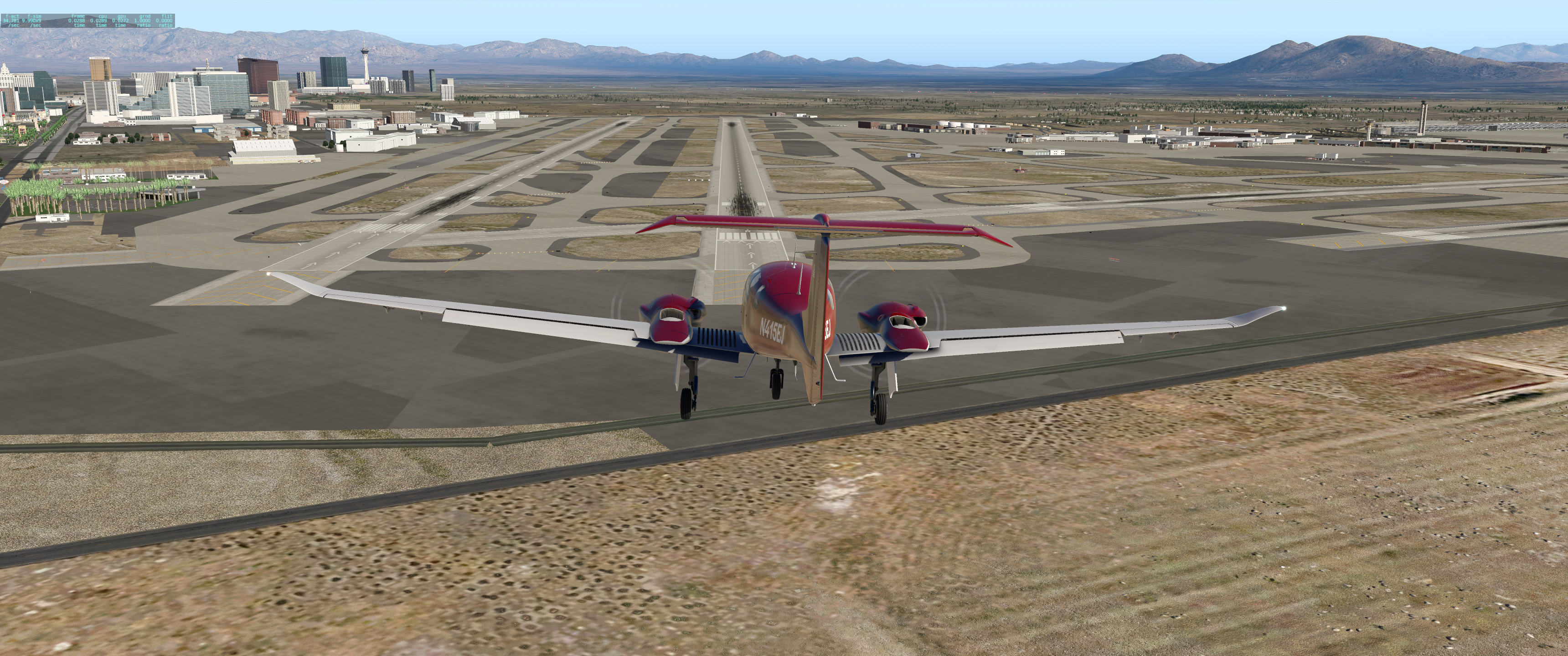
Flew from Scottsdale, AZ (KSDL) to Las Vegas (KLAS) this evening to try out a new bit of software (xVision) that tunes X-Plane’s shaders for more appealing visuals. Great flight, even with the default scenery! xVision does make everything look nicer, I think!
Btw, my landings are getting better*, but my approaches are still sloppy, mostly because I haven’t gotten good at figuring out when & how to change the views (to look out the side windows, for instance).
*Lies 
Bruh, you actually managed to get me… I was like “Damn, Hazel out here doin some work”.
Until I read the next sentence…
Also I like your set up. It reminds me of my younger times when the Ps2 had a whole mock/controller wheel with gas peddles to control a car. ![]()
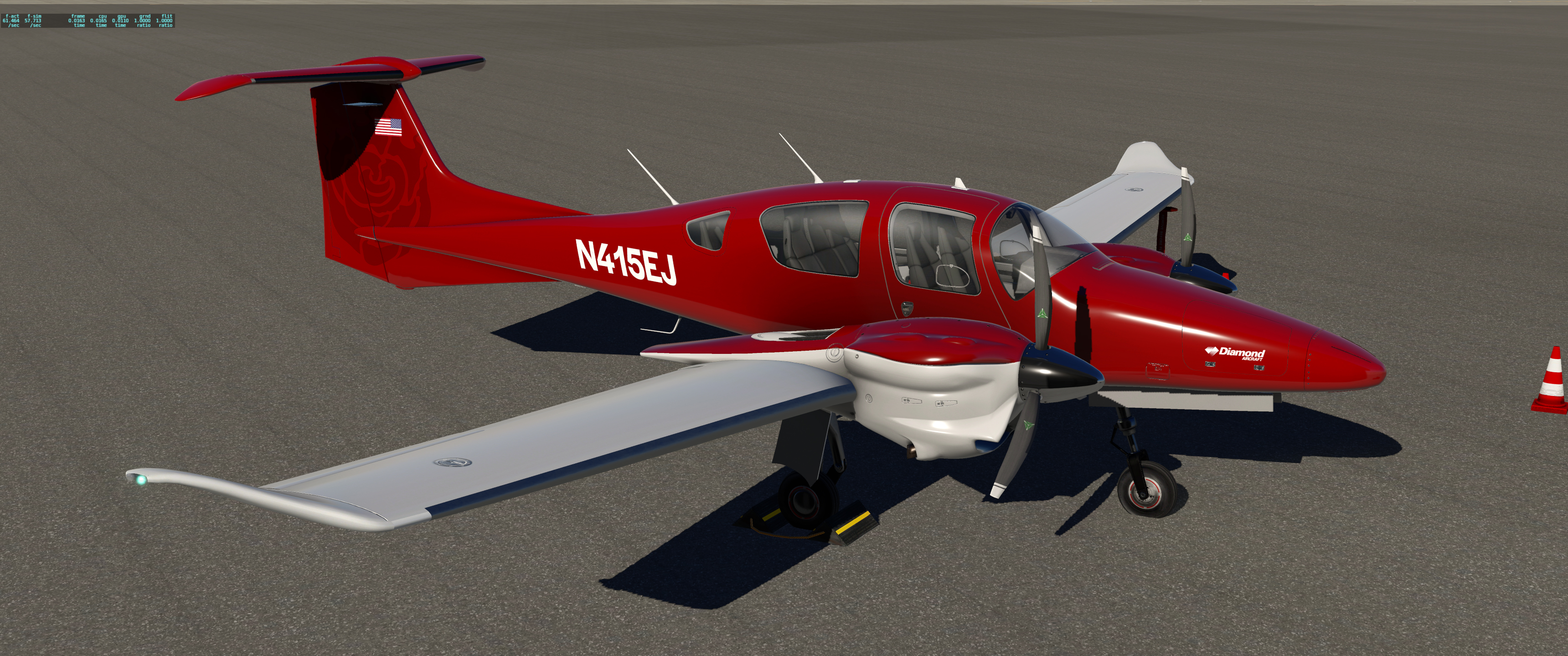
Worked on the paint scheme for a while tonight: the secondary color is going to be a silver/gray, and I finally started on it by painting the wings. (If you compare them to the lower part of the engine nacelles you’ll see the difference.) I also changed the prop spinners to a polished aluminum finish, then I spent a lot of time finding and fixing defects (i.e., parts that should have been colored but weren’t) in the red primary color. Last but not least, I added Ruby’s emblem to the right side of the vertical stabilizer to match the one on the left side.
I’m pretty happy with it so far. I want to add a metallic look to the paint, but X-Plane uses a weird file format for its texture maps, so getting the result I want is not as straightforward as I’d like.
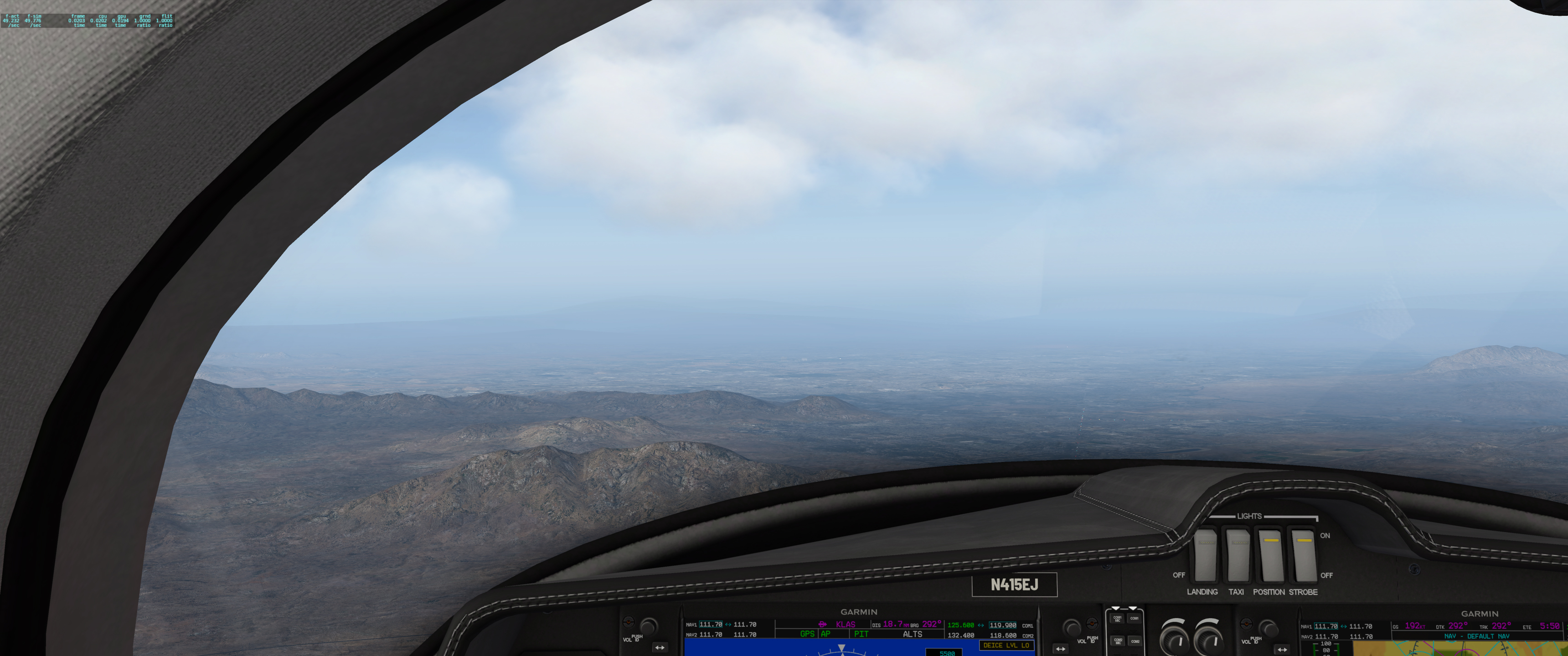
So I thought I’d show a little bit about how technology has improved situational awareness and safety in general aviation in the past 10 years. All of these images are from a simulated flight between Las Vegas (KLAS) and Los Angeles (KLAX) that I made this afternoon. The first image shows what my “flight deck” looks like for a typical flight. Over on the left, my iPad is running ForeFlight and is showing my planned route overlaid on a VFR sectional chart. In the center are the Garmin G1000 Primary Flight Display showing the flight instruments and the Multifunction Display showing navigation information. On the far right is my StreamDeck which lets me press buttons to do stuff like raise and lower the flaps and landing gear so I don’t have to try to remember key commands.
The view above is from a few miles out of Las Vegas, just after reaching my cruising altitude of 10,500 ft MSL.
With about 30 minutes to go, there’s one last mountain range to cross, and it includes the highest point on my route. Even though I planned my cruise altitude to clear the peaks by over 1000 ft, they look a little concerning from here. How to be sure I’m going to be okay?
For one thing, I have terrain alerting turned on on the G1000, and the MFD (the right screen) isn’t showing any warnings, which is reassuring by itself. But I can also use ForeFlight to cross check and get even more information about what’s ahead:
Here, I’ve activated ForeFlight’s “synthetic vision” feature, which gives me a virtual 3D view of the terrain around me. If the terrain is green, there are no hazards at or near my current altitude. Straight ahead looks fine, though there’s one tall peak (shown in yellow) that could be a problem were I to deviate to the left of my course.
ForeFlight can also display a vertical profile of my flight that updates in real time, and that’s what is shown above. As planned, I’ll clear any terrain on my route by 1400 ft. So, time to enjoy the views!
Hope you enjoyed the flight! 
If this were a REAL flight, I’d have planned to cross those mountains at a much higher altitude, because an engine failure in the mountains could quickly turn into a catastrophe, even in a twin engine aircraft.
Although all twins are theoretically able to climb with one engine inoperative, there are many circumstances where you might not be able to do so and in fact, actually lose altitude even with the remaining engine at full power. Pilots often remark that that the good thing about engine failures in a twin is that the remaining engine will always get you to the scene of the crash.
With more altitude, I’d have more options for places to land as well as more time to troubleshoot the failed engine and possibly get it restarted.
It’s my day off, and I’ve just arrived at KJWN in Nashville, headed over to preflight the aircraft for an early morning flight to KTRI – the weather is great here, not so good in east Tennessee at the moment …
Currently learning how to fly a H135 and this looks like a lot of fun  although I’m not a big fan of planes, personally
Also, I had no idea you were a pilot !!
Irl? Cool!!! ![]()
Your word choice always makes me feel like you are actually flying in real life
It feels pretty close to the real thing, tbqh! Flying the sim has helped me recover many of the skills and habits that have grown rusty over the past 10 years – if you’d told me a few weeks ago that a $60 piece of software running on a home PC would be so faithful to the real thing, I wouldn’t have believed it.
The improvements in technology for general aviation and realism in flight simulation over the last decade have been astounding to me!
That said, I’m within a few weeks of getting back into the airplane in real life as well – I’m planning on getting my medical certificate in January, and I hope to have an instructor lined up so I can get back in the air by the middle of February!
![]() A little personal history: The first flight simulator software I ever encountered way back in 1979 was SubLOGIC’s A2 FS1 by Bruce Artwick … the GIF is pretty accurate in representing the frame rate, btw!
A little personal history: The first flight simulator software I ever encountered way back in 1979 was SubLOGIC’s A2 FS1 by Bruce Artwick … the GIF is pretty accurate in representing the frame rate, btw!
My best friend and I had to know what was on the other side of those mountains, so we flew our little imaginary airplane through them to the other side … and out into space, apparently, because there was nothing there! (You could fly through them because there was no collision detection in those days – the simulator only knew you crashed when your altitude was zero  )
)
)
Decided to try hooking up a spare monitor to see what kind of difference extending my view to the sides would make in the experience of flying the sim: it turns out to make a WORLD of difference!
I can see that multiple monitors are in my future … 

Getting properly aligned images on multiple monitors is harder than I expected! Fortunately, there’s software available to help! Most people with serious setups (using multiple projectors, for example) seem to use software from Fly Elise-ng. They have software for use with LCD displays as well – here’s me designing a multiple monitor setup using Immersive LCD PRO. Once the design is laid out, one button exports the settings for use with the flight simulator (or any other app you want to spread over multiple monitors).
Now, I just need to figure out how to mount everything … and a GoFundMe page to pay for it all 
One of the top questions being asked of the Microsoft Flight Simulator development team is whether FS 2020 will feature seasons – something that’s lacking from other flight simulator software … they posted this short video to their YouTube channel in answer to that question 
Although I’ve been quiet here lately, I’ve been busy in the flight simulation arena for the past 10 days – I’ve discovered the VATSIM network and have been absorbed in trying to learn as much as I can about it.
If you’ve followed this thread, you may recall my post about PilotEdge, an online network that allows simulator pilots to see one another and to interact with air traffic controllers in a very realistic approximation of real world flying.
Well, VATSIM is a much larger online network that spans the entire globe, and unlike PilotEdge, it’s completely free to join and use. However, the quality of the ATC services varies, and most facilities are staffed only intermittently. (That’s the advantage of PilotEdge: all facilities are fully staffed during operating hours.) VATSIM is also a bit more complex to get set up, but once you do, it provides a wealth of features that surpass even those offered by PilotEdge (example: VATSIM controllers and pilots can use the CPDLC system to issue & receive clearances via text rather than over the radio).
VATSIM’s US division is called VATUSA, and just like the real US airspace, it’s divided into sections under the control of different (virtual) Air Route Traffic Control Centers. One of the most active and highly regarded is the Boston Virtual ARTCC – operations there are very professional, and they have a number of training programs available to help you improve your skills.
Joining the Boston VARTCC requires taking an exam and filling out an application – once you’ve done that and installed the appropriate VATSIM plugin for your flight simulator (xPilot is the one for X-Plane), you’re in and able to start flying in their airspace.
As you may have guessed, I joined BVARTCC last week, and I’ve been familiarizing myself with the various airports and procedures in the airspace. On my day off today, I’m getting the orthophoto scenery for the northeast US processed and installed in X-Plane. I’ve also added a detailed version of Boston’s Logan Airport (KBOS). I’ll post some pics once everything’s set up and I actually do some flying!