Got my FAA third class medical certificate today! Now all I need is my flight review, and I’ll be legal and current to fly again!
1 Like
Flying commercial to Florida today for a business trip — our aircraft missed its release time because of a maintenance issue, so we had to sit in the penalty box holding area for about 30 minutes awaiting a new clearance from ATC.
I’m pretty sure this bird who decided to perch on our left winglet was there just to laugh at us:

1 Like

I’ve got my first flight in almost 11 years scheduled for later this week! We’ve got the aircraft reserved for 3 hours of flight time, and the forecast is for clouds but no precipitation, so things are looking promising!!!  (getting a little nervous)
1 Like


The weather was a little sketchy today, but in addition to spending some time on the ground getting some instruction on the avionics, we managed to get in a few laps around the traffic pattern: logged 3 takeoffs and landings and 1.0 hours of flight time – my first in almost 11 years!
The Cirrus is SO much fun to fly! And my instructor is fantastic!

Weather looks perfect today! I’ve got the aircraft reserved between 9 am and 4 pm, and the forecast is VFR for the entire time — winter weather here in middle TN can change fairly drastically in a short time, but it looks like we should be able to get a full day in today!

Got to the airport a couple hours early to avoid the infamous Nashville traffic, so it’s time for a relaxing breakfast at the Centennial Cafe!

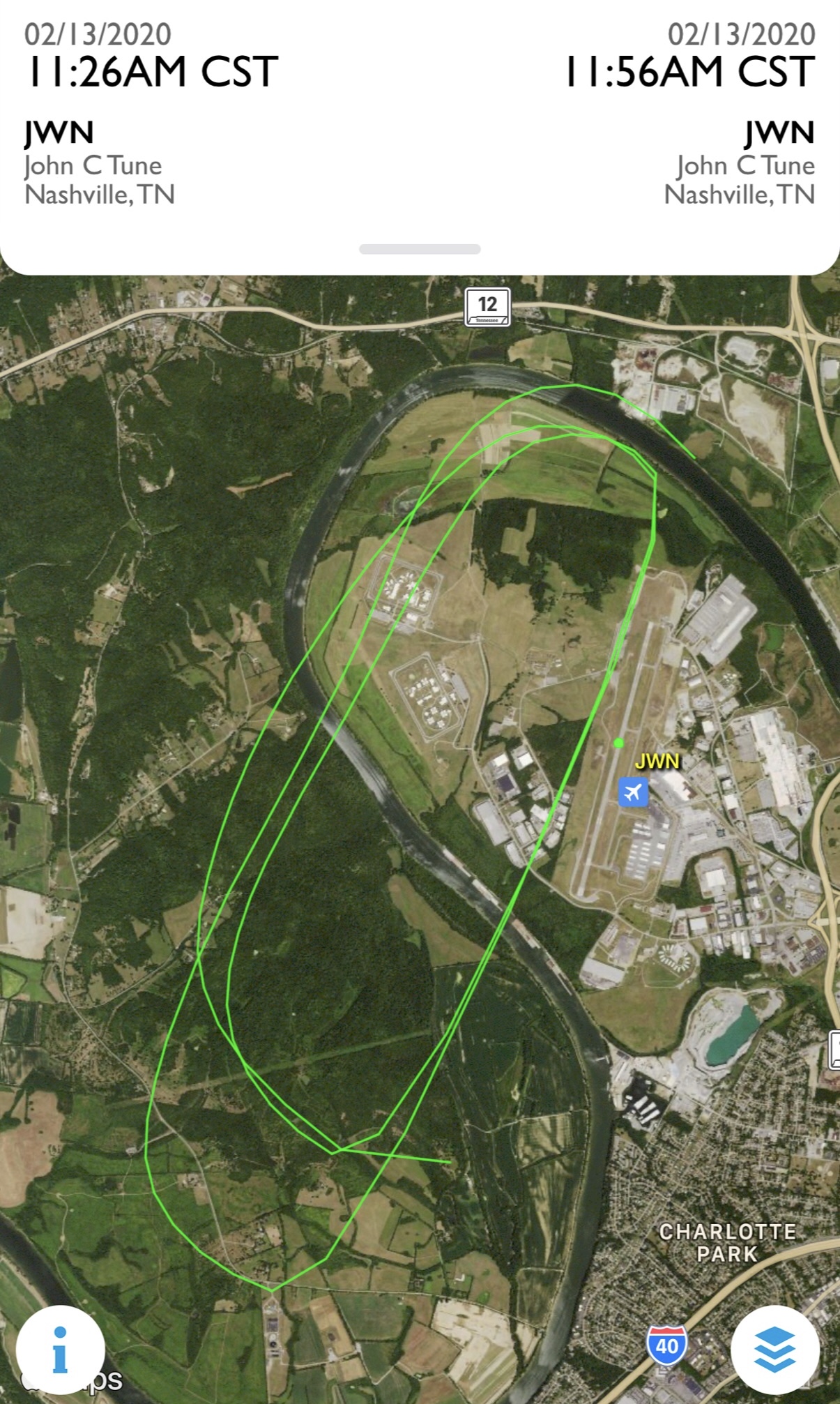
![]() Here’s the ground track of the first of my two flights today – we took off out of Nashville, then headed north where you might be able to see where we practiced steep turns, slow flight, and stalls, then did a whole bunch of landings of different types up in Kentucky before finally heading back to Nashville.
Here’s the ground track of the first of my two flights today – we took off out of Nashville, then headed north where you might be able to see where we practiced steep turns, slow flight, and stalls, then did a whole bunch of landings of different types up in Kentucky before finally heading back to Nashville.
![]() A couple of quick snaps from the left seat (my instructor took the controls for a moment so I could get these)!
A couple of quick snaps from the left seat (my instructor took the controls for a moment so I could get these)!


1 Like

![]() Here’s the flight path for yesterday’s second flight (after lunch!) – unlike the track shown in the post above, which was recorded by Foreflight on my iPad using data from the Garmin navigation system in the aircraft, this track is from the ADS-B data broadcast by the aircraft to receivers on the ground. It’s quite accurate, but ADS-B reception isn’t perfect, especially at low altitudes, such as in the traffic pattern at airports or when taking off or landing. Thus, the web site I used to show the flight path (FlightAware.com) doesn’t show every part of this flight.
Here’s the flight path for yesterday’s second flight (after lunch!) – unlike the track shown in the post above, which was recorded by Foreflight on my iPad using data from the Garmin navigation system in the aircraft, this track is from the ADS-B data broadcast by the aircraft to receivers on the ground. It’s quite accurate, but ADS-B reception isn’t perfect, especially at low altitudes, such as in the traffic pattern at airports or when taking off or landing. Thus, the web site I used to show the flight path (FlightAware.com) doesn’t show every part of this flight.
If anyone’s interested, here’s a link to the flight on FlightAware – you can actually play back the flight to see speed and heading changes, altitude changes, and so forth. It’s pretty amazing! ![]()
Two more flights yesterday – and I completed the Cirrus SR20 transition course! The last landing of the day was literally perfect (in aviation, it’s known as “a greaser” – where you can barely tell the aircraft has touched down on the runway), and when we shut down the engine, my instructor pronounced me a Cirrus pilot  Because I also completed a flight review (required by the FAA every 2 years) earlier this week, I am now legal to fly AND officially qualified to fly the latest version of the SR20!
Here’s the first flight of the day:

![]() The morning flight included a bunch of takeoffs and landings at Springfield Robertson Airport (M91) followed by a quick trip to Dickson Municipal Airport (M02) – there was quite a crosswind there, so we decided to head home to Nashville for lunch after a quick landing and takeoff.
The morning flight included a bunch of takeoffs and landings at Springfield Robertson Airport (M91) followed by a quick trip to Dickson Municipal Airport (M02) – there was quite a crosswind there, so we decided to head home to Nashville for lunch after a quick landing and takeoff.

![]() In the afternoon, we flew up to Portland Municipal Airport (1M5) for more takeoff and landing practice, at which point we finished the flight requirements for the SR20 transition course. My instructor decided we would start some instrument training on the way back home, since we still had the aircraft reserved for another 90 minutes or so.
In the afternoon, we flew up to Portland Municipal Airport (1M5) for more takeoff and landing practice, at which point we finished the flight requirements for the SR20 transition course. My instructor decided we would start some instrument training on the way back home, since we still had the aircraft reserved for another 90 minutes or so.
If you look at the track above, you’ll see it become extremely straight as it passes between Orlinda and Cross Plains: that’s when we turned on the autopilot, which my instructor had programmed to fly a practice instrument approach into Springfield. The teardrop shaped path at the bottom left is called a procedure turn, and it turns the aircraft 180 degrees to the inbound course toward the runway. When we got about 2 miles from the airport, my instructor had me hand fly the rest of the way to the landing. After leaving Springfield, we did one more approach into John Tune Airport (our home base), then broke off as we neared the airport and circled to land on Runway 02 to finish out the flight.
1 Like
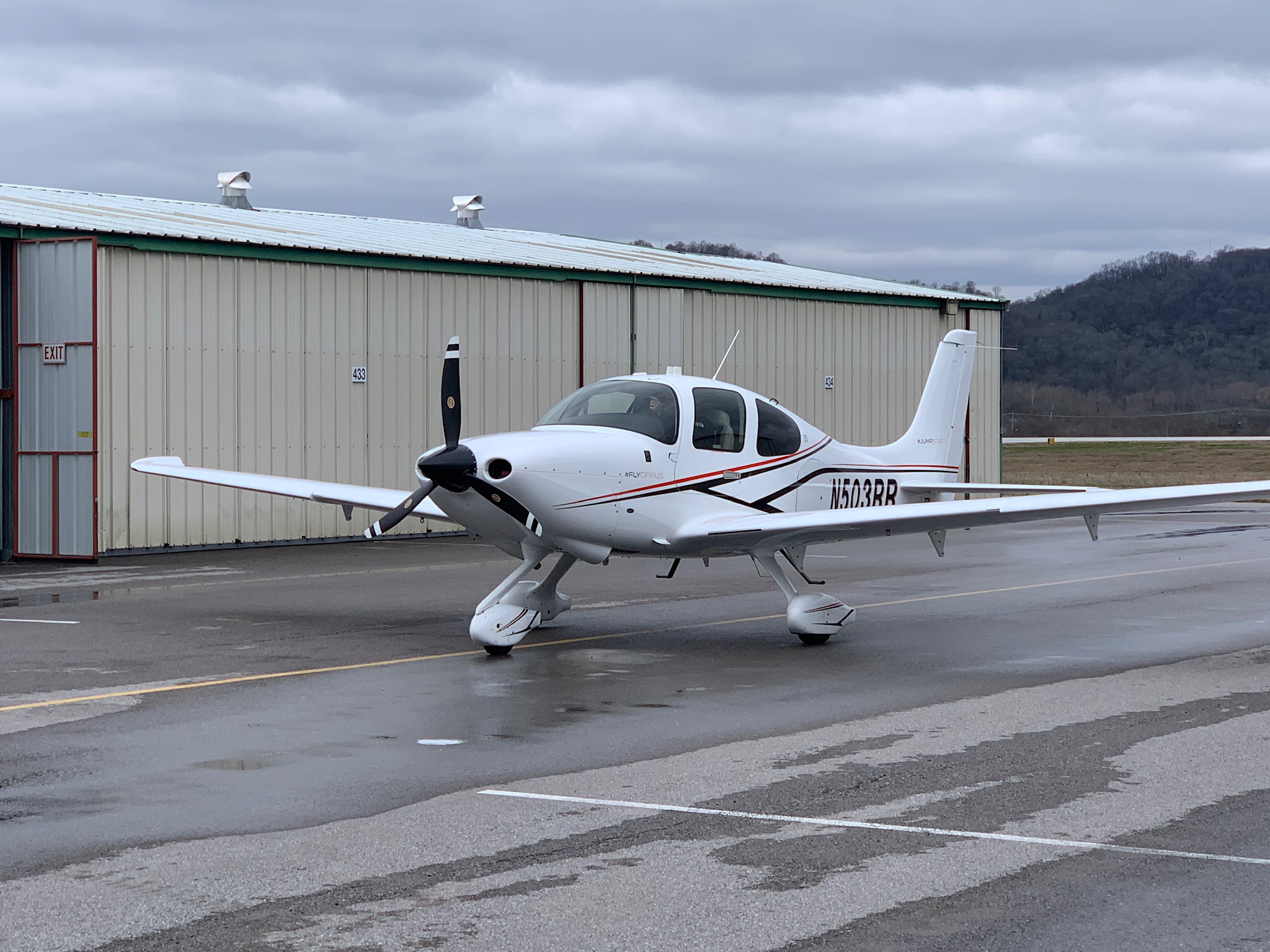
The sad end of N503RR, that beautiful Cirrus SR20 pictured above and an airplane I quickly fell in love with, is documented in this thread. My flying is on hold for a while, I’m sorry to say, as there’s no telling at this point when the airport or the flight school will reopen.
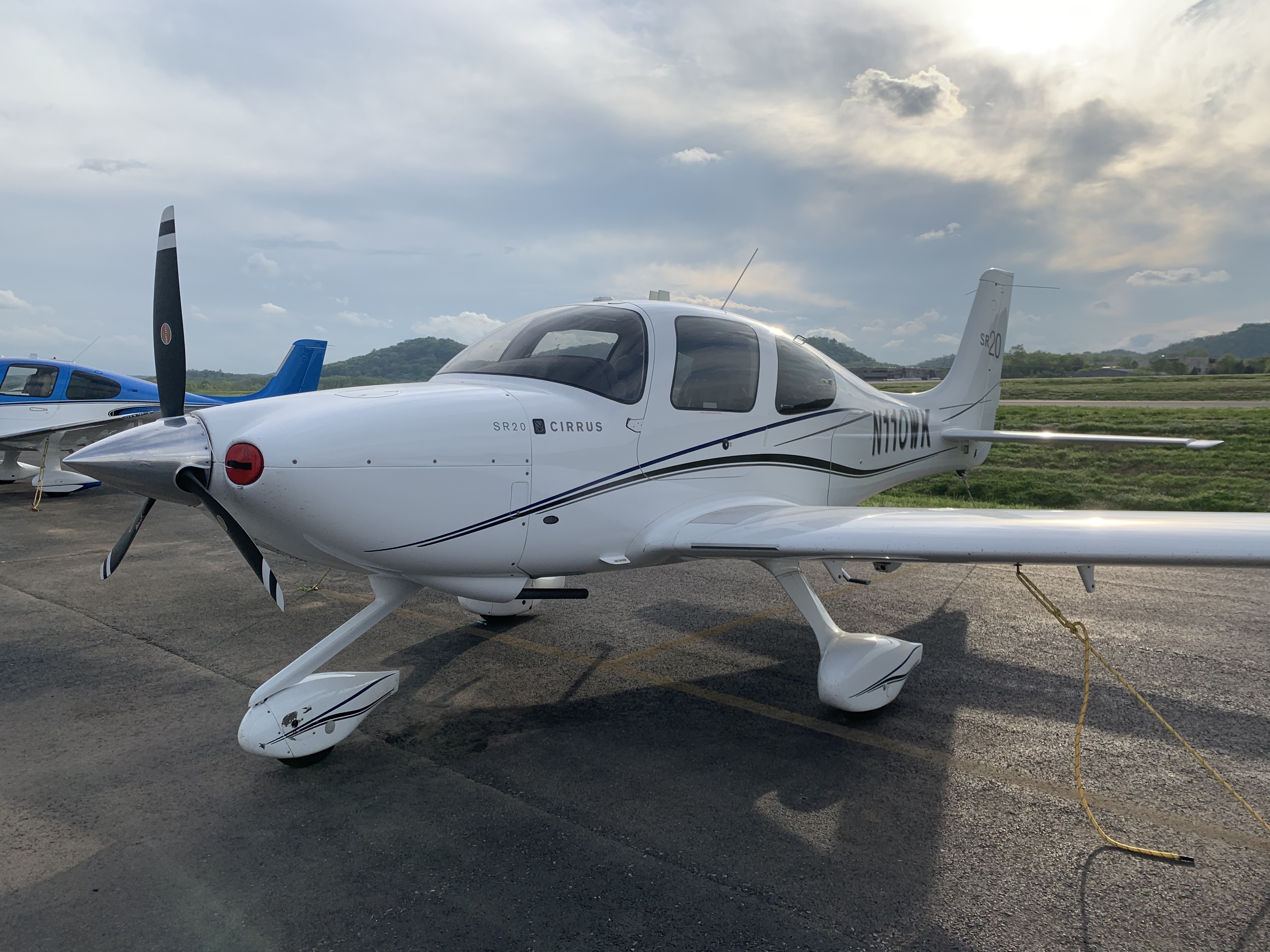
Just got word from my flight instructor that the airport may reopen by Monday morning (March 16). Out of the 9 aircraft in the flight school’s fleet, only 3 survived the tornado: two Cessna 172s which were away from the airport for maintenance and a Cirrus SR22. This particular SR22 is an older model – built in 2004, it’s 3 generations behind in terms of avionics, but it’s still quite a capable aircraft: it’s significantly faster than the SR20 I was flying, and it’s fully equipped for instrument flying – and has some equipment (such as a TKS anti-icing system and a StormScope) that isn’t available on the SR20.
Since we’re now working on instrument training, the weather matters much less than it did for VFR (visual flight rules) flying – in fact, I’d prefer to have some good, solid cloud layers to practice in!
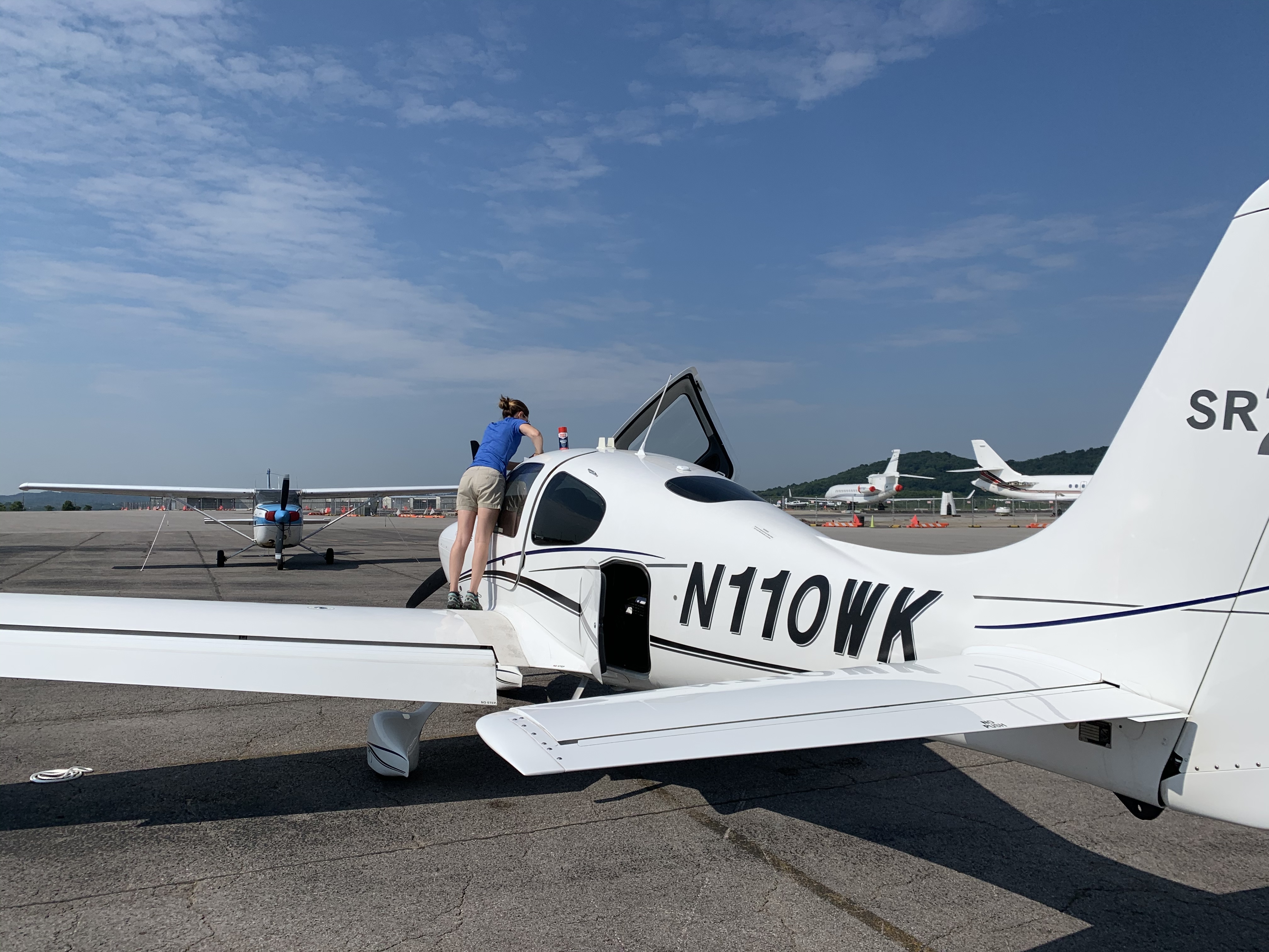
We weren’t the very first aircraft to launch from John C. Tune Airport today, but according to the line folks, we were the second! Here’s a look at the aircraft I flew today:
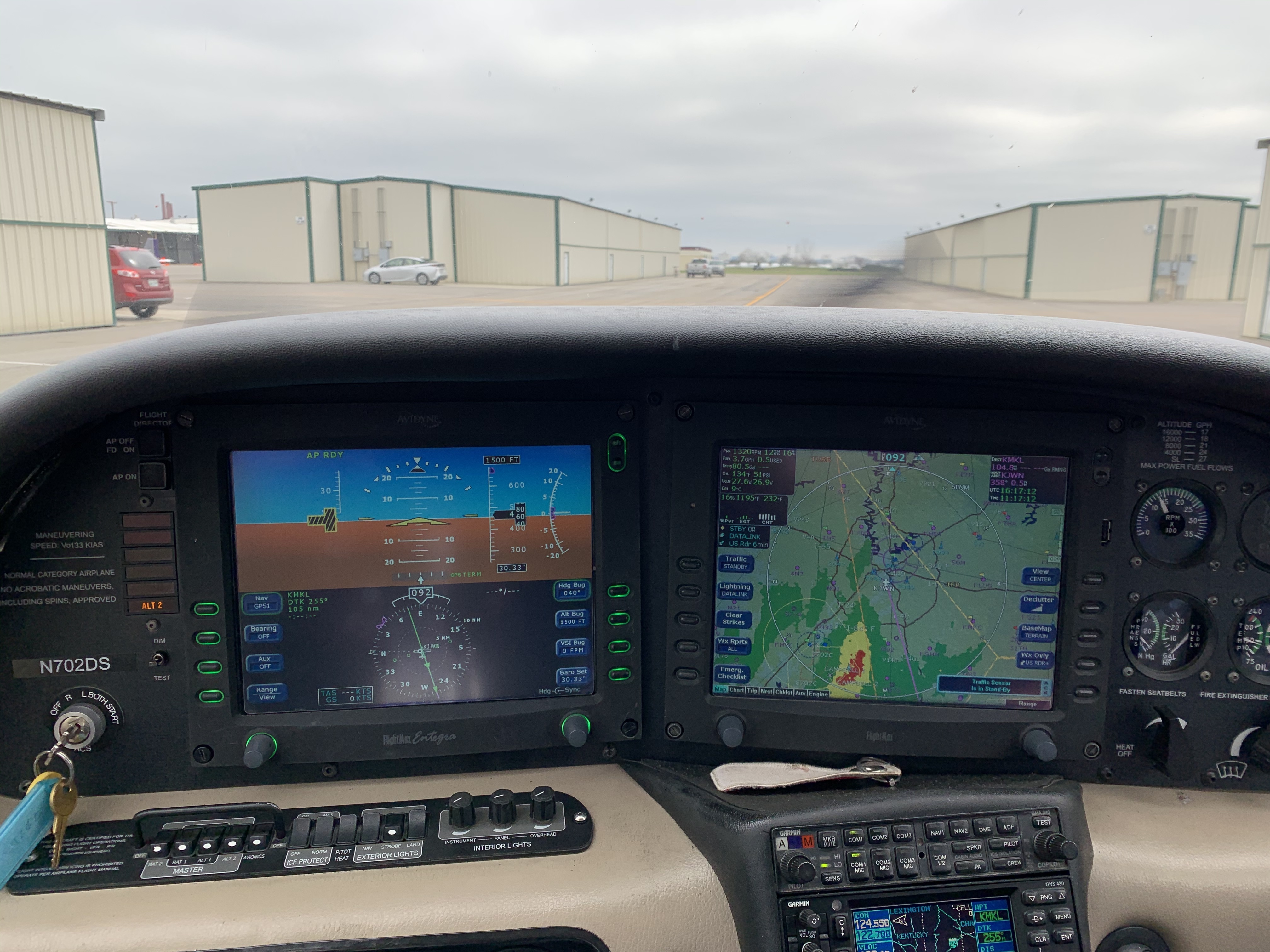
Here’s our route of flight from John Tune (KJWN) to McKellar-Sipes Regional Airport (KMKL) to Beech River Regional Airport (KPVE) and back to John Tune:
This was an instrument training flight, so other than on takeoff and landing, I had to wear glasses that limited my view to the instrument panel, so I don’t have any in-flight pictures to share, unfortunately.
After we touched down at John Tune, I was taxiing back to the hangar along a curved taxiway, I saw several people standing by their vehicles overlooking the runway. As we approached, they waved and cheered, which initially puzzled me. After we shut down the engine in front of our hangar and started unloading the plane, a pickup truck drove up and one of the men whom I’d seen waving rolled down the window – he had a huge grin on his face and called my landing a “10 out of 10 – perfect!” and said that it was great to see an airplane flying into John Tune again.
It was great to get back into the air today, but that gentleman’s comment was a reminder that there’s still a long way to go before things return to anything resembling normal at John Tune. It was also a great example of how in many ways people who love aviation make up one big family: just like a family, they come together at times of crisis or hardship.
It was a very memorable day.
2 Likes
Ooh man it must be hella nice to experience this for real.
1 Like
Made three IFR training flights with my wonderful instructor over the past two days – we had a great time, and I learned a ton! The weather for today’s flight was pretty much perfect for instrument training: we were in actual IMC (instrument meteorologic conditions) for about half the time. (The rest of the time, I had to wear “Foggles” which are glasses that limit my view to the instrument panel. A safety pilot – my instructor, in this case – is required when simulating instrument conditions in that way.)


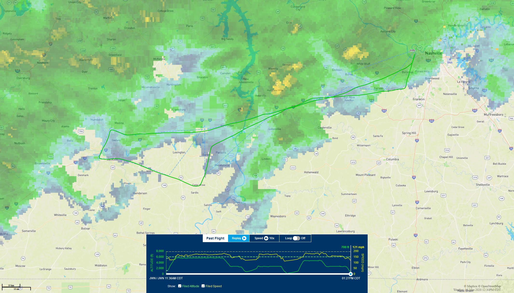
![]() My instructor likes to plan flights with three legs, so we get 3 instrument approaches per flight. We spent most of the time in Kentucky this week because of sketchy weather forecasts (possible thunderstorms, which are massively dangerous to aircraft) to the south of us. I hand flew (no autopilot) the entire time, which was great for getting to know the aircraft and for honing my instrument skills. By the third flight, I was consistently right on our assigned headings and altitudes.
My instructor likes to plan flights with three legs, so we get 3 instrument approaches per flight. We spent most of the time in Kentucky this week because of sketchy weather forecasts (possible thunderstorms, which are massively dangerous to aircraft) to the south of us. I hand flew (no autopilot) the entire time, which was great for getting to know the aircraft and for honing my instrument skills. By the third flight, I was consistently right on our assigned headings and altitudes.
Btw, if you look closely at the 3rd image above, in the upper left part of the route (near Paducah, Kentucky), you’ll see a sort of loop in our flight path. Air traffic control was unable to immediately clear us for the approach because someone was already in that airspace, so we were instructed to hold at the initial approach fix. A hold is basically a looping course near a point in space (a “fix”) that is used by ATC when they need an aircraft to wait for further clearance. We only made one loop in the hold before we received clearance for the approach.
I mentioned getting to know the aircraft: the owner of the flight school has leased an SR20 that’s several years older than the one that was destroyed in the tornado. It has newer avionics than the SR22 I flew last (see the post above this one), but it also has a smaller engine and is quite noticeably slower. (That’s not a terrible thing during training, as the time it adds to each flight helps build the time I need for my instrument rating. However, I would not want to own an SR20 with this particular engine.)
Here are some pics from the past two days:


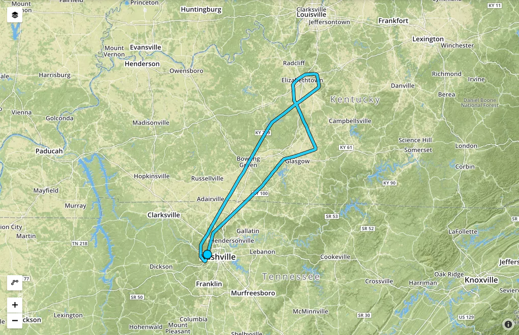
Because of my schedule, bad weather, and aircraft maintenance, I hadn’t flown since April 9th (the date of the my last post in this thread!), but things finally worked out as planned today, and I logged 4.9 hours of instrument flight and 5.3 hours total today! We flew to Huntsville, AL in the morning, then came back via Muscle Shoals, AL to Nashville for lunch. Then it was off to Owensboro and Bowling Green, KY in the afternoon before returning to Nashville to end the day. Lots of great practice with the autopilot, the flight director, and some hand flying of all sorts of approaches – plus, I wasn’t nearly as rusty as I thought I’d be after > 2 months away from the airplane!
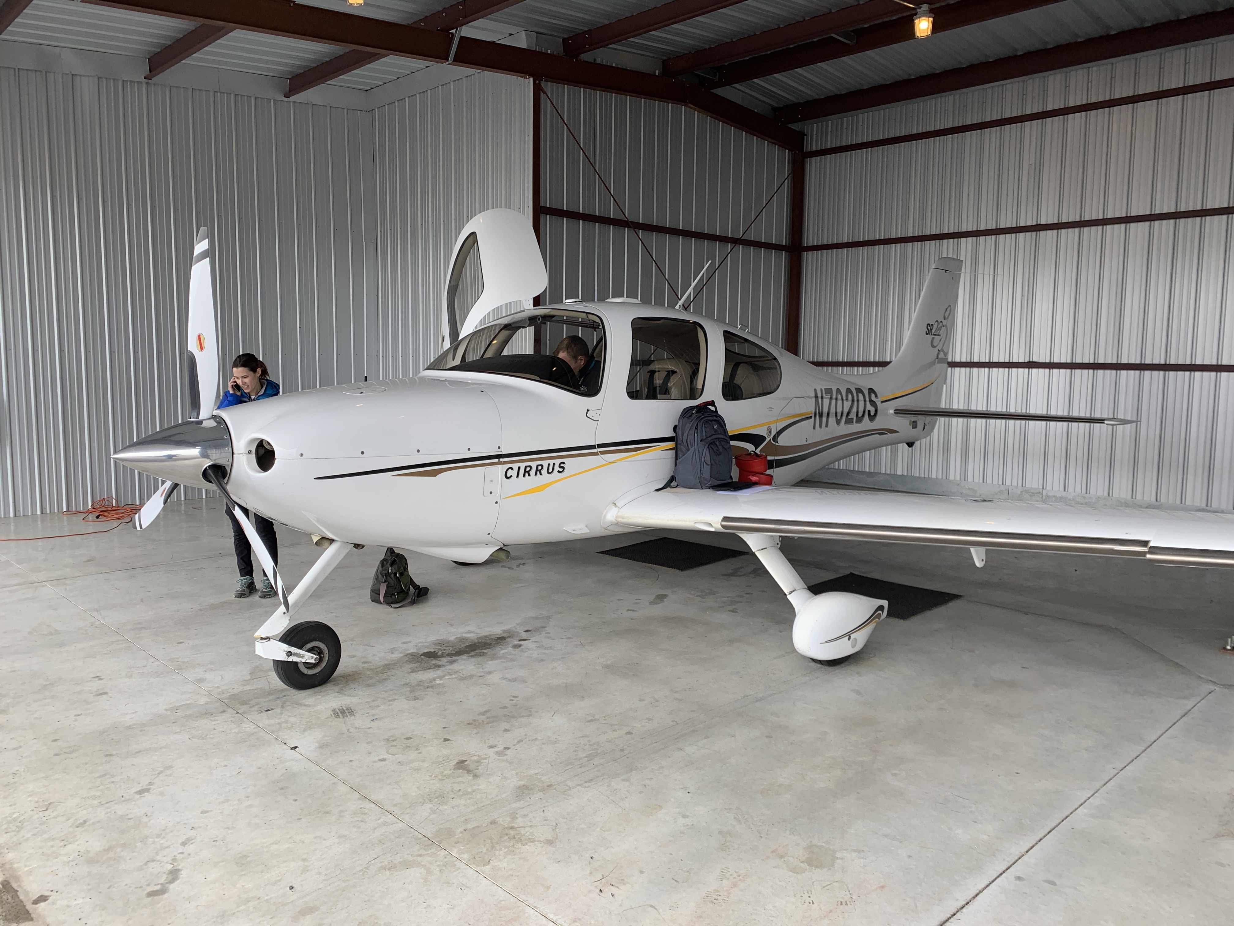
Some photos I snapped as we were preparing to depart KJWN this morning – Sarah is cleaning the windscreen (or as she calls it, “the bug screen”) in some of them, even though as an instrument student, I don’t get to look out of it very much 


1 Like

Long trip today! We flew from KJWN in West Nashville to McGhee Tyson (KTYS) in Knoxville, then over to Tullahoma (KTHA), and finally back to Nashville – almost 4 hours in the air! Flew 3 approaches, 2 of which included circling to land on a different runway from the approach, which was great practice. Also got in a go-around, as someone ahead of us was very slow to get clear of the runway when we were on final approach. 
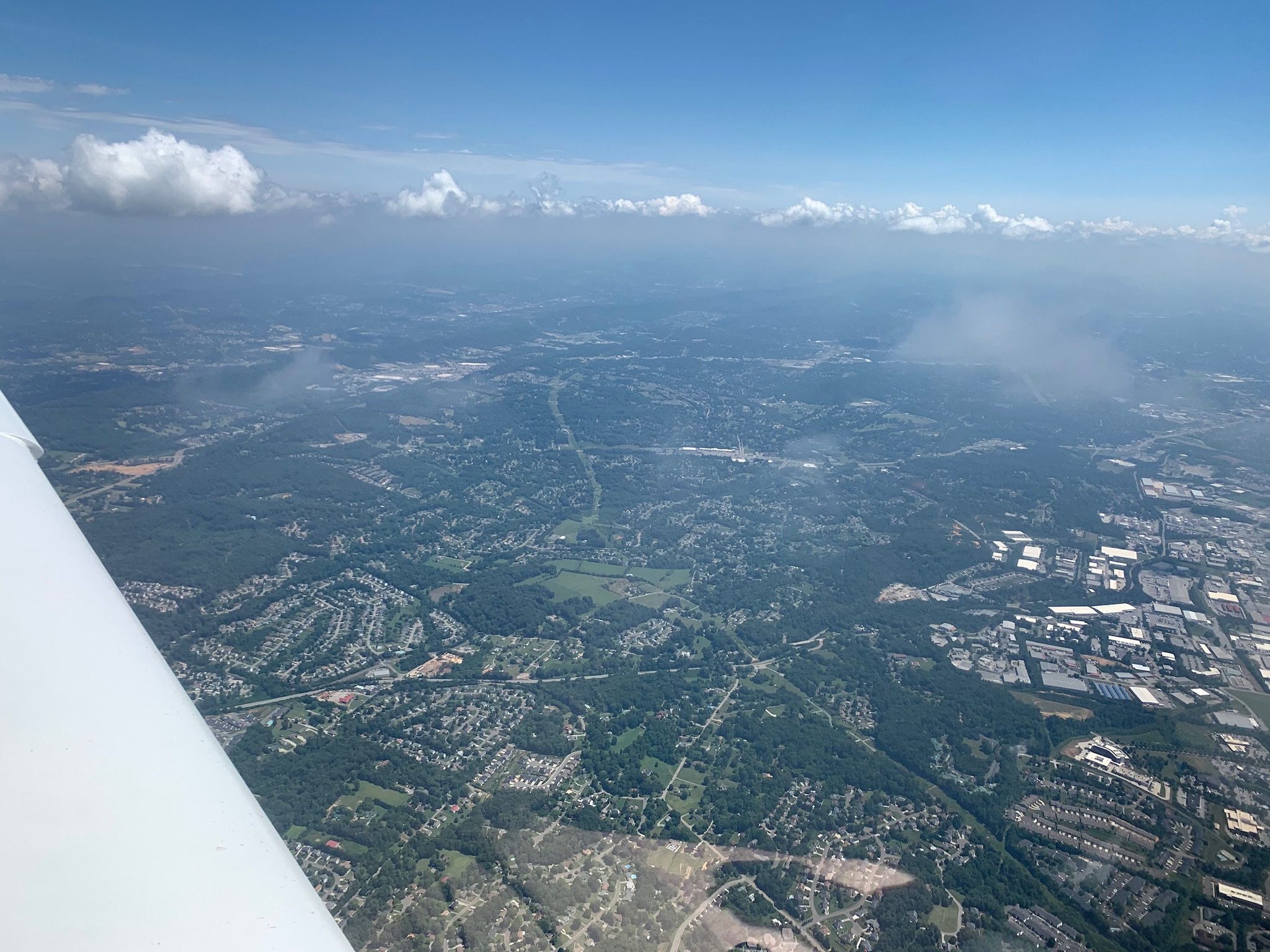
I managed to sneak a few photos while we were nearing Knoxville:

We had planned to fly again after a lunch break, but a line of summer thunderstorms started to form just to the west of us, so we called it a day.
Have two days of flying scheduled beginning this afternoon: a long cross-country instrument flight, some night flying, and then more cross country instrument training tomorrow! Will post an after-action report after the … eh, action.
EDIT: We ended up not flying yesterday due to thunderstorms throughout the area. Trying again today!
Successfully completed one of the major requirements for my instrument rating today: the long cross-country flight! The flight had to be conducted under instrument flight rules with an instrument instructor, be > 250 nm in total, and include 3 instrument approaches using different navigation systems. We decided to fly from our home airport in Nashville to Knoxville, then back to Springfield-Robertson Airport, then back to Nashville. Here’s the actual flight path, which included a diversion for weather on the leg to Springfield:

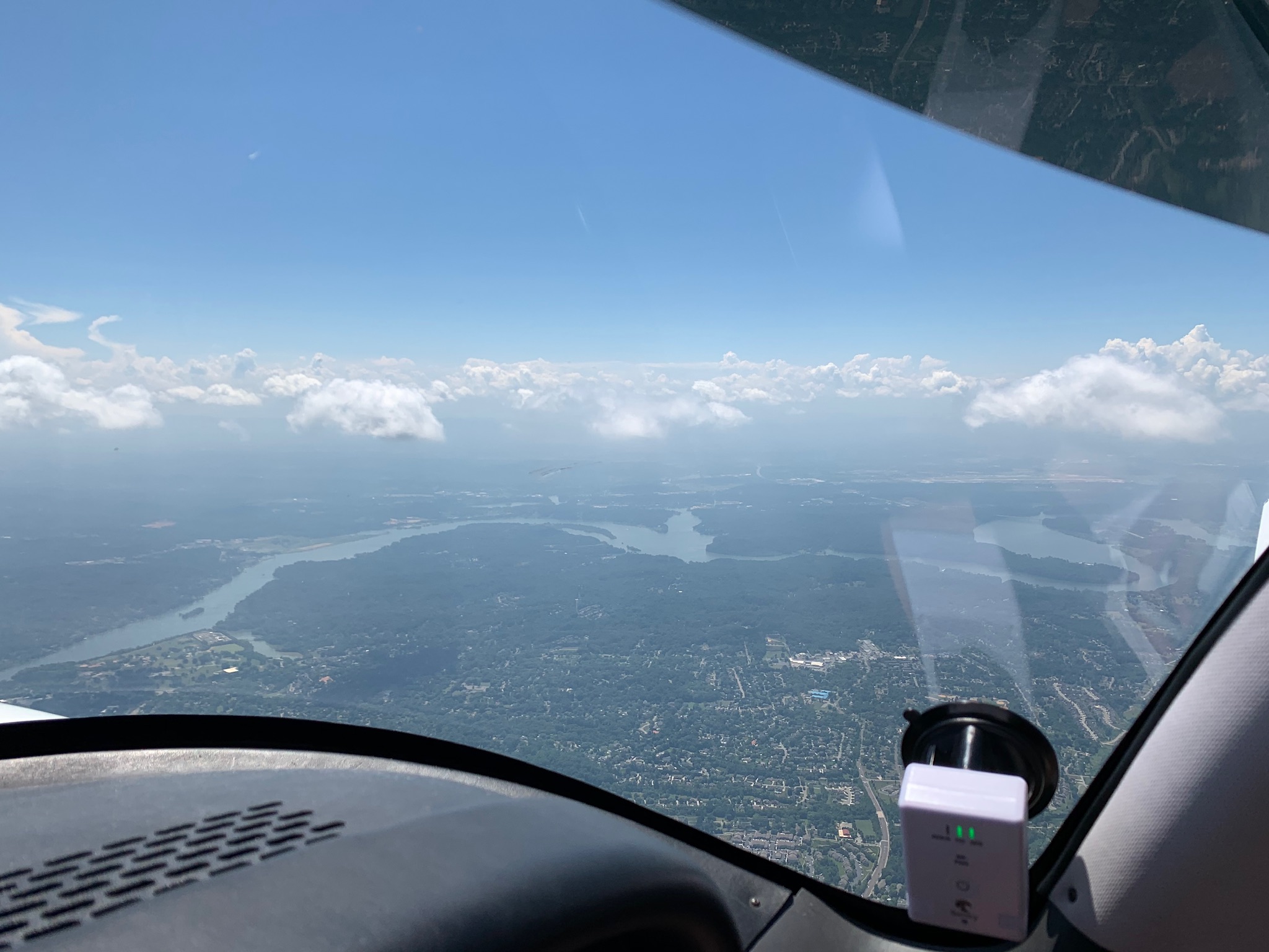
Air traffic control routed us over downtown Nashville on the way to Knoxville, so my instructor gave me the chance to snap a few pictures before she made me put the “foggles” back on:


The trip was extremely fun and interesting, and I’m getting much more comfortable managing the workload of IFR flying. At this point, I have only 15.5 hours remaining to complete the time requirements to take the instrument check ride, so next I’ll be studying to get ready for my written exam, which I need to pass before taking the check ride.
I’ve got two more days scheduled before the end of the month – hopefully there will be fewer afternoon thunderstorms as we get closer to fall here in middle Tennessee!
Sorry in advance for the long post, but I had a very interesting day yesterday!
I had reserved the aircraft from 2 pm - 10 pm so I could get in some night flying, as I hadn’t flown at night since my night cross country as a student pilot. Flying at night is beautiful, and as VFR pilot, I found it challenging and disorienting: everything looks VERY different at night, and it’s difficult to judge distances, see obstructions – even locate airports, despite all their lighting. Landing at night is much tougher than during the day, as many visual cues are missing, and some darkness-induced visual illusions can lead to rough landings … or worse … if you’re inexperienced and/or not careful. Now that I have a fair amount of instrument experience, I wanted to see whether I would be more comfortable flying on instruments at night than I was flying looking out the windows.
All that said, our first flight of the day started in the mid afternoon, and it being a typical middle Tennessee afternoon, there was a bit of weather in the area. Most of it consisted of cumulus clouds, though some contained some precipitation, so we tried to stay clear of those to avoid getting tossed around. Here’s the route of flight:

On the first leg of the trip, we had to deviate from our planned course for some weather – that’s the sort of jagged track from Nashville (orange dot) to the lower left part of the overall path. Here’s some of the spectacular scenery we got to enjoy along the way:


The weather during the rest of the flight was fairly unremarkable, and we only encountered rain once. We made our approaches to Carroll County Airport and Henderson County Airport, then headed back home to Nashville … or so we thought!
As you can see from the track log at the top of this post, our flight didn’t end (blue dot) at the same point from which we started (orange dot). That’s because we were alerted by air traffic control that John Tune Airport (our home base) was closed due to “a disabled aircraft on the runway.” 
This could be anything from landing with a dead engine and needing to be towed to the ramp all the way up to a crash resulting in someone getting hurt, so naturally, this caused some consternation because we’d have to find somewhere else to land and more than a little concern for the pilot and any passengers aboard the stricken aircraft. ATC had no further information for us, so we asked them to amend our IFR clearance to let us land at Springfield Robertson Airport, about 20 miles from Nashville.
We landed without incident and called Contour Aviation, the FBO at John Tune, to see if we could find out what was going on. It turned out that someone had landed with their landing gear up, and while the plane was severely damaged, the pilot (who was flying alone) was unhurt. The airport was likely to be closed for another hour or two, though, so we decided to get dinner, then refuel the plane to set off on our planned night flight.
Here are some photos of the airport in Springfield – I hope you can get a sense of the wonder and adventure and romance of aviation from these, because standing there last evening, those feelings were as strong as I’ve ever felt them:


We asked someone at the airport for a recommendation for somewhere to eat, and she offered us her car so we could drive there. (This is pretty normal for general aviation, in case you’re wondering – people are extremely friendly and generous in ways you would never imagine. It’s like going back in time to an age where kindness and hospitality were the norm.) Here’s where we ended up, and the food was fantastic:


After returning our new friend’s vehicle, we refueled the plane, then set off for our second flight of the day …

Because our earlier flight had been long, we decided to make this night flight pretty simple: we flew north to Owensboro, KY, made an approach and landing there, then flew back to Nashville, which by now was open again. As I mentioned at the beginning of this post, I’d been curious to know whether I would feel more comfortable flying at night with a lot more experience with instrument flying than I had as a VFR pilot – and it turned out that I was! Flying at night felt exactly like flying during the day (except for having to use a flashlight in the cockpit at times), and I even managed two pretty good landings – not bad for not having made a night landing in 11 years!
Unlike during our daytime flight, the weather was perfectly clear during this second flight, and the view out the windows was spectacular – especially as we reached Nashville. It was hard to photograph, unfortunately, but here are a couple of images that don’t begin to do justice to how pretty it all was:


After landing and shutting down, I was tired but pretty proud of what I’d accomplished in just a single day. And I’m finally getting close to completing the time requirements for my instrument rating – which means I’ve got to hit the books for my written exam!
1 Like
Just realized I haven’t posted in this thread for a while, probably because work has been busy and because I’ve been flying a LOT this month!
This week, I completed all of the flight time requirements for my instrument rating, and I’m now working with my instructor to fill in a few gaps in my training in order to prepare for my checkride. This week, we made a couple of flights to practice less common instrument approaches as well as things like holding procedures. Here’s what one of those flights looked like:

The flight started and ended at John Tune Airport on the west side of Nashville (it’s the blue dot on the left of the track). You might notice that the first part of the track is a curve arcing around the magenta ring that’s centered on Nashville International Airport (BNA): that magenta ring indicates the extent of the controlled airspace around BNA, and so it’s helpful to be able to avoid that if you’re not flying into Nashville. We were VFR on this day, so we flew around the airspace using a procedure called a DME arc – basically, we set our instruments to show our distance from a radio navigation aid (a VOR, to be technical) located at BNA, and we used those instruments to fly in an arc that maintained the same distance from the VOR until we got to the approach course for the airport to which we were headed (Sumner Co. Regional in the upper right). We then flew to Springfield Robertson Co. in the upper left, then went off to the northeast of the airport to practice holds. (Those are the funny racetrack-looking parts of the flight path.) After another approach at Springfield, we flew home to Nashville to refuel and eat lunch.
1 Like